
Key Points
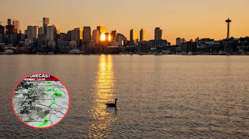
- Seattle is expecting a shift to warm, sunny conditions this weekend after a Saturday featuring cloud cover and patchy drizzle.
- Temperatures are forecasted to climb into the mid-to-upper 70s on Saturday, with Sunday potentially reaching near 80°F.
- A high of 80°F on Sunday could break the daily record of 77°F, which was set in 1992.
- The National Weather Service (NWS) indicates that an offshore flow will peak on Sunday and Monday, contributing to the warming trend.
- While the start of the week remains dry and sunny, a return of onshore flow by Tuesday is expected to moderate temperatures back toward the low 70s.
- The current atmospheric setup is characterized by high pressure building into the Pacific Northwest, suppressing marine layer effects.
Seattle (King County Insider) May 2, 2026 — Residents across the Seattle metropolitan area are preparing for a notable spike in temperatures this weekend, as a ridge of high pressure moves into the Pacific Northwest to deliver summer-like warmth. According to the latest update from the FOX 13 Seattle Weather Team, the region is transitioning from a cooler, cloudier start on Saturday to a potentially record-breaking warm Sunday.
As reported by the meteorological staff at the National Weather Service (NWS) and reiterated by the FOX 13 Seattle Weather Team, Saturday began with onshore flow, bringing cloud cover and areas of patchy drizzle to Western Washington. However, meteorologists anticipate that these conditions will clear throughout the afternoon, leading to mostly sunny skies and high temperatures reaching the mid-to-upper 70s. This sets the stage for a significantly warmer Sunday, where the potential for setting a new daily record high becomes the primary focus for regional weather watchers.
The NWS forecast suggests that Sunday’s high could reach approximately 80°F. As noted by the Hoodline report covering the event, a high near 81°F is possible in some inland areas, which would comfortably eclipse the existing daily record of 77°F set in 1992. This surge in heat is being attributed to a brief turn in low-level flow to an offshore direction, which effectively warms the inland air and minimizes the typical cooling influence of the Pacific Ocean.
Beyond Sunday, the warming trend is expected to persist into the start of the workweek. The high-pressure ridge, which has been the primary driver of this heat, is forecast to remain over the region through Monday. However, this period of intensified heat will be short-lived. By Tuesday, forecasters expect a shift back to onshore flow, which will help moderate temperatures and return them to a more seasonal, though still above-average, range in the low 70s.
Why is the Pacific Northwest experiencing this specific warming trend?
The current development of near-record heat in Seattle is largely driven by a high-pressure system building across the Pacific Northwest, a common, though seasonally early, atmospheric pattern. When this high-pressure ridge stabilizes over the region, it effectively acts as a lid, suppressing the marine layer that typically keeps Western Washington cool.

According to analyses often cited by regional meteorologists, including discussions on the Cliff Mass Weather Blog regarding early May weather patterns, these “brief warm surges” are a recognized feature of the Pacific Northwest climate. High pressure forces air to descend and compress, which inherently warms it, and when combined with a shift in wind direction—specifically to an offshore flow—it prevents the influx of cooler, moist maritime air. This specific combination of factors is what allowed the region to target temperatures nearing 80°F this weekend, far exceeding the typical early May climatological averages for the Seattle area.
How will this temperature development affect the local audience?
For the residents of Seattle and the Surrounding Western Washington area, this weekend’s weather development serves as a significant shift in outdoor activity potential, though it brings specific considerations. The immediate impact will be felt by those planning outdoor recreational activities, as the transition to dry, sunny conditions provides a rare, mid-spring opportunity to enjoy temperatures well above the historical average.
However, the local audience should be aware of the “sun-to-shade” temperature disparity and the potential for heat-related risks. While temperatures in the upper 70s and near 80°F are highly pleasant for most, they are significantly warmer than what the local population has acclimated to over the previous months, which have trended generally cooler. Residents are encouraged to monitor their hydration and take advantage of the afternoon clearing to enjoy the outdoors, while being mindful that the incoming cooler, onshore flow by Tuesday will rapidly reset the environment to more moderate, seasonal norms. Furthermore, those operating small watercraft should remain attentive to maritime conditions, as offshore flow can influence coastal wind patterns even as inland temperatures soar.