
The cafés near the Tiger Mountain trail entrance in King County, Washington, are popular because they provide convenient rest stops for travelers exploring the Cascade foothills, scenic forest roads, and elevated driving routes near Issaquah. Visitors using Interstate 90 often stop in the foothill corridor before or after hiking, photography trips, or scenic drives through the Tiger Mountain State Forest area. The surrounding region combines evergreen forests, gradual elevation changes, mist-covered ridges, and mountain pull-offs that attract both road trip travelers and outdoor enthusiasts.
The Tiger Mountain foothill region sits east of Seattle near Issaquah, North Bend, and Snoqualmie Pass. The area functions as a transition zone between the Seattle metropolitan landscape and the western slopes of the Cascade Mountains. Scenic drives around Tiger Mountain are especially known for dense conifer forests, winding elevation roads, rain-fed greenery, and seasonal visibility changes throughout the year.
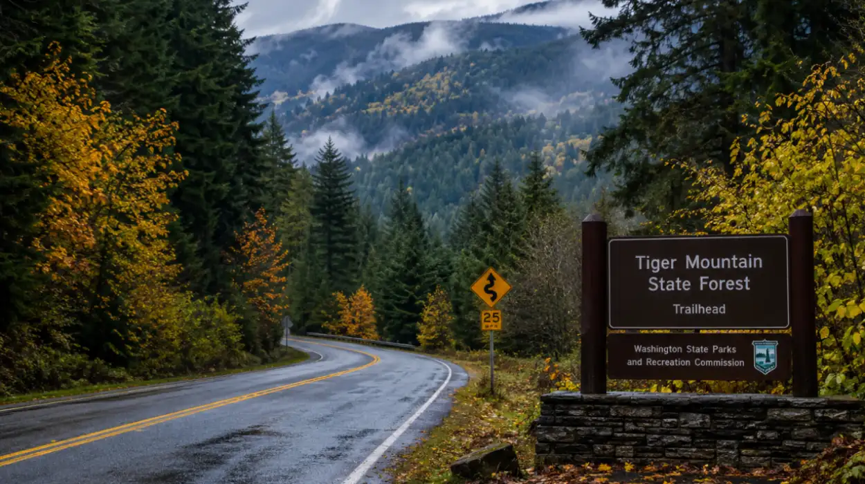
Travelers often use cafés near the trail entrance as planning points before entering the forest road network or after completing routes through nearby viewpoints, trailheads, and scenic pull-off locations.
What Makes the Tiger Mountain Foothill Driving Routes Unique in King County?
The Tiger Mountain foothill driving routes are unique because they combine lowland suburban access with immediate forest elevation gain. Unlike longer mountain highways in Washington State, the Tiger Mountain area allows visitors to experience changing landscapes within a short driving distance from Issaquah.
The route network surrounding Tiger Mountain includes Interstate 90, Issaquah-Hobart Road Southeast, Southeast Tiger Mountain Road, and connections toward North Bend and Snoqualmie Valley. Drivers quickly transition from urban corridors into heavily forested roads lined with Douglas fir, western red cedar, and moss-covered slopes.

During autumn, the foothill roads display orange and yellow foliage mixed with evergreen forests. In winter, fog and low clouds create atmospheric driving conditions that attract photographers looking for moody Pacific Northwest scenery. Spring introduces dense greenery and waterfall runoff near roadside creeks, while summer provides clearer mountain visibility and extended daylight for scenic stops.
The driving experience near Tiger Mountain differs from major Washington scenic byways because it emphasizes close forest immersion rather than wide-open alpine landscapes. Narrower roads, elevation curves, and shaded forest corridors create a slower-paced travel environment focused on exploration instead of destination travel.
Where Are the Best Scenic Pull-Off Points Near Tiger Mountain Trail Entrance?
Several scenic pull-off points near the Tiger Mountain trail entrance provide views of forests, valleys, and foothill transitions throughout King County. These roadside locations help visitors experience the natural geography without completing long hiking routes.

High Point Way and Tiger Summit Access Areas
The High Point area near Tiger Mountain offers elevated forest scenery with limited roadside stopping opportunities. Drivers traveling through this section experience dense evergreen surroundings and gradual elevation changes that create layered visual depth during foggy mornings and rainy afternoons.
During early morning hours, low cloud movement through the trees creates ideal photography conditions for Pacific Northwest landscape images. Autumn mornings often produce soft lighting conditions that photographers prefer for forest compositions.
Issaquah-Hobart Road Scenic Segments
Issaquah-Hobart Road functions as one of the most visually balanced foothill drives near Tiger Mountain. The roadway passes forest edges, rural clearings, and small elevation viewpoints that reveal portions of the surrounding valley landscape.
This route becomes especially attractive during spring because roadside vegetation thickens rapidly after seasonal rainfall. Travelers often stop briefly at wider shoulder areas to capture roadside forest imagery and changing terrain patterns.
Snoqualmie Valley Overlook Connections
Road connections leading toward Snoqualmie Valley offer broader landscape visibility compared to the enclosed Tiger Mountain forest corridors. Visitors driving northeast encounter wider valley perspectives, layered hillsides, and changing weather patterns that create dynamic scenery throughout the day.
The combination of valley visibility and nearby forest access makes this area popular for travelers seeking both panoramic and close-range landscape photography.

How Does the Forest and Elevation Transition Shape the Scenic Experience?
The forest and elevation transition around Tiger Mountain significantly shapes the visitor experience because the terrain changes rapidly across relatively short distances. Travelers move from suburban Issaquah streets into dense conifer ecosystems within minutes.
Lower elevation areas contain mixed vegetation, roadside wetlands, and open foothill spaces. As elevation increases, the forest canopy becomes thicker and darker due to taller evergreen tree coverage and reduced sunlight penetration.
This environmental transition creates strong visual contrast throughout the driving route. Rainfall accumulation also changes with elevation, which affects road atmosphere, visibility, and forest coloration. Higher sections often retain fog longer than nearby valleys, particularly during late autumn and winter.
The Pacific Northwest climate intensifies these transitions. Moisture accumulation supports thick moss growth, fern-covered roadside banks, and constantly green forest conditions that remain visually appealing throughout the year.
Drivers frequently describe the Tiger Mountain foothill corridor as immersive because the forest environment surrounds the roadway almost continuously in certain sections. Unlike open desert or coastal drives, the experience here emphasizes enclosed natural scenery and gradual environmental transformation.
When Is the Best Seasonal Driving Experience Near Tiger Mountain?
The best seasonal driving experience near Tiger Mountain depends on the type of scenery visitors want to experience in the Cascade foothills.
Autumn Creates the Most Atmospheric Scenic Conditions
Autumn is widely considered the strongest season for scenic driving near Tiger Mountain because fog, wet roads, and changing foliage combine to produce dramatic forest visuals. Morning drives during October and November often include low clouds drifting through evergreen slopes.
Roadside leaves create color contrast against darker conifer forests, making the foothill environment especially attractive for photography-focused visitors.
Spring Enhances Waterfall and Forest Visibility
Spring conditions improve forest brightness and water flow throughout King County foothill areas. Seasonal rainfall increases creek activity near roadside drainage channels and nearby trail systems.
The forests appear especially vibrant between March and May because moss growth, ferns, and undergrowth become more visible after winter moisture accumulation.
Summer Provides Clearer Mountain Sightlines
Summer offers longer daylight hours and improved visibility toward surrounding ridges and valleys. Dry road conditions also make the foothill routes more accessible for casual travelers unfamiliar with mountain driving.
Weekend traffic tends to increase during summer due to hiking activity around Tiger Mountain State Forest and nearby recreation areas.
Winter Creates Moody Pacific Northwest Road Scenery
Winter driving near Tiger Mountain is popular among photographers and scenic road enthusiasts because of heavy fog layers, rainfall patterns, and cloud-covered forests.
Snow occasionally appears at higher elevations, though road conditions vary depending on weather systems moving through the Cascade region.
Why Do Photography Travelers Visit the Tiger Mountain Foothill Region?
Photography travelers visit the Tiger Mountain foothill region because it provides multiple landscape environments within a compact geographic area. The combination of forests, elevation transitions, mist, roadside scenery, and changing seasonal light creates strong visual diversity.
Photographers often focus on:
- Fog movement through evergreen forests
- Wet road reflections during rainfall
- Forest texture and moss-covered trees
- Valley visibility near Snoqualmie connections
- Seasonal foliage transitions
- Atmospheric roadside compositions
The Pacific Northwest weather system contributes heavily to the visual appeal of the region. Overcast lighting softens shadows and increases forest color depth, which many landscape photographers prefer over harsh direct sunlight.
Early morning remains the best time for roadside photography because fog density is usually higher before midday temperature increases.
The Tiger Mountain foothills also support slower travel pacing compared to heavily commercial scenic destinations. Visitors can stop frequently without the congestion commonly associated with larger national park corridors.
How Do Nearby Foothill Connections Expand the Scenic Road Trip Experience?
Nearby foothill connections expand the Tiger Mountain scenic road trip experience by linking travelers to additional Cascade foothill destinations across King County.
Issaquah serves as the primary gateway community for Tiger Mountain access. The city connects travelers to Interstate 90 while also providing entry toward smaller rural road networks.
North Bend adds additional mountain scenery through connections toward Snoqualmie Pass and the upper Snoqualmie Valley region. Travelers continuing east encounter larger elevation changes and broader mountain visibility.
The Snoqualmie area complements Tiger Mountain because it introduces waterfalls, river scenery, and historic mountain corridor landscapes. Together, these locations create a broader Pacific Northwest foothill exploration route suitable for day trips and photography-focused drives.
Rural roads near Hobart and Maple Valley also extend the foothill driving network through quieter forest environments with reduced traffic density.
What Should Visitors Know Before Driving Near Tiger Mountain Trail Entrance?
Visitors should prepare for changing weather conditions when driving near Tiger Mountain because visibility and road atmosphere shift quickly throughout the foothill environment.
Rain is common during much of the year, especially from late autumn through spring. Wet pavement, fog, and shaded forest curves require slower driving speeds in certain sections.
Cell service can fluctuate in deeper forest corridors depending on elevation and tree density. Travelers planning extended scenic drives should review route conditions beforehand, especially during winter weather periods.
Parking near popular trail access areas becomes limited on weekends due to hiking traffic. Early morning arrival generally provides easier access and calmer photography conditions.
Visitors should also expect variable lighting conditions because dense tree coverage reduces direct sunlight in many areas. This contributes to the region’s atmospheric appearance but can create darker driving environments during cloudy weather.
What Related Scenic Experience Complements a Tiger Mountain Visit?
If you are visiting this area, you may also want to explore: scenic drive through Tiger Mountain foothills.
This complementary travel experience expands the foothill exploration beyond the immediate trail entrance area and helps visitors discover longer forest road connections, broader valley transitions, and additional roadside viewpoints across King County. It supports travelers looking for a complete Pacific Northwest driving route that combines elevation scenery, forest immersion, and seasonal photography opportunities before or after visiting the Tiger Mountain corridor.
Frequently Asked Questions About Tiger Mountain Scenic Travel
Is Tiger Mountain good for scenic driving in Washington State?
Yes, Tiger Mountain is popular for scenic driving because it combines dense forests, foothill elevation changes, and atmospheric Pacific Northwest weather close to Seattle and Issaquah. The roads provide easy access to forest scenery without requiring long-distance mountain travel.
What is the best time to visit Tiger Mountain for photography?
Autumn and winter are the best seasons for photography near Tiger Mountain. Fog, rainfall, and changing foliage create dramatic forest conditions that are ideal for roadside landscape photography and scenic pull-off imagery.
Are there scenic pull-off points near Tiger Mountain trail entrance?
Yes, several roadside areas near High Point Way, Issaquah-Hobart Road, and Snoqualmie Valley connections provide scenic stopping opportunities for photography, forest viewing, and short breaks during foothill drives.
How far is Tiger Mountain from Seattle?
Tiger Mountain is located east of Seattle in King County near Issaquah. Most visitors can reach the foothill area in approximately 30 to 45 minutes depending on traffic conditions along Interstate 90.
Does Tiger Mountain have good fall colors?
Yes, Tiger Mountain displays strong autumn scenery because deciduous foliage contrasts with evergreen forests throughout the foothill region. October and early November typically provide the best seasonal color visibility.
Can visitors explore Tiger Mountain without hiking?
Yes, visitors can experience much of the foothill scenery through scenic driving routes, roadside viewpoints, photography stops, and nearby forest roads without completing long hiking trails.