
West Seattle provides the most complete coastal urban travel experience in King County by pairing miles of public Puget Sound shoreline with direct vistas of the Downtown Seattle skyline and the Olympic Mountains. Situated on a peninsular landmass southwest of Elliott Bay, West Seattle distinctively combines saltwater recreation, urban beach culture, and historic maritime infrastructure. Unlike central downtown districts, this geographic orientation offers unblocked marine views, extensive pedestrian promenades, and seamless transit connections via municipal ferries and major bridges.
How Does the Puget Sound and Skyline Contrast Define West Seattle’s Shoreline?
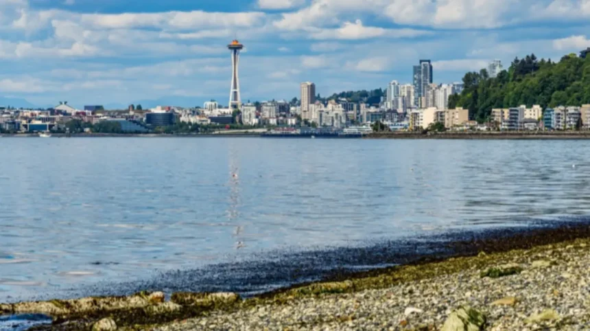
The geographic orientation of West Seattle creates a dramatic visual contrast between the Pacific Northwest marine environment and the dense urban core of King County. Located directly across Elliott Bay from downtown, the peninsula acts as a natural front-row observation deck. Visitors standing along the coastline look across open saltwater directly at iconic landmarks, including the Space Needle, Columbia Center, and the Great Wheel, framing the cityscape against the backdrop of Mount Rainier and the Cascade Range.
This shoreline geometry separates West Seattle from other regional coastal areas. While nearby shorelines face industrial zones or open water, West Seattle’s northeastern exposure captures the full panorama of downtown, while its western exposure faces Bainbridge Island and the snow-capped Olympic Mountains across Puget Sound. This dual exposure provides distinct micro-landscapes within a single geographic area, ranging from bustling urban waterfronts to quiet saltwater tide pools.
What Is the Coastal Neighborhood Structure of West Seattle?
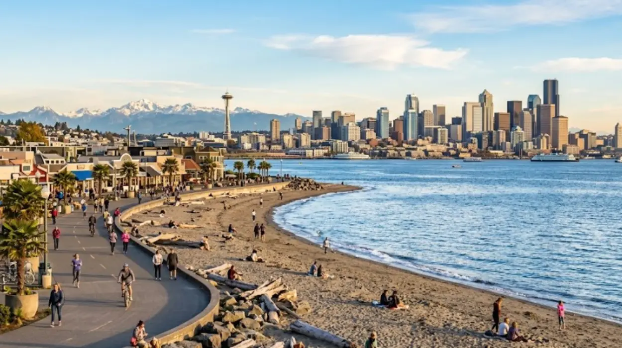
The West Seattle peninsula is structured around several distinct coastal corridors, each defined by unique topographies, marine access points, and community layouts. Understanding this geographic layout helps travelers navigate the regional travel flow efficiently.
1. The Alki Point Corridor
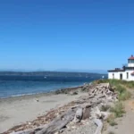
Extending along the northern and western tip of the peninsula, Alki Point serves as the primary hub for beach activities. It features a 2.5-mile continuous pedestrian pathway running parallel to Alki Avenue SW. The terrain is flat, providing level access to sandy beaches, tide flats, and historic navigational markers like the Alki Point Lighthouse.
2. The West Seattle Junction and Ridge
Elevated above the shoreline, the central spine of the neighborhood—known locally as The Junction—acts as the commercial anchor. Roads descend steeply from this central ridge toward the water, creating natural greenbelts, hidden stairways, and high-elevation scenic overlooks that look down upon Elliott Bay and Puget Sound.
3. The Fauntleroy Shoreline
Located on the southwestern edge of the peninsula, Fauntleroy offers a forested, quiet coastal layout. Centered around Fauntleroy Cove and the active Washington State Ferries terminal, this district features rocky shores, marine ecosystems, and direct access to regional parklands like Lincoln Park.
Which Scenic Overlooks Provide the Best Views in West Seattle?
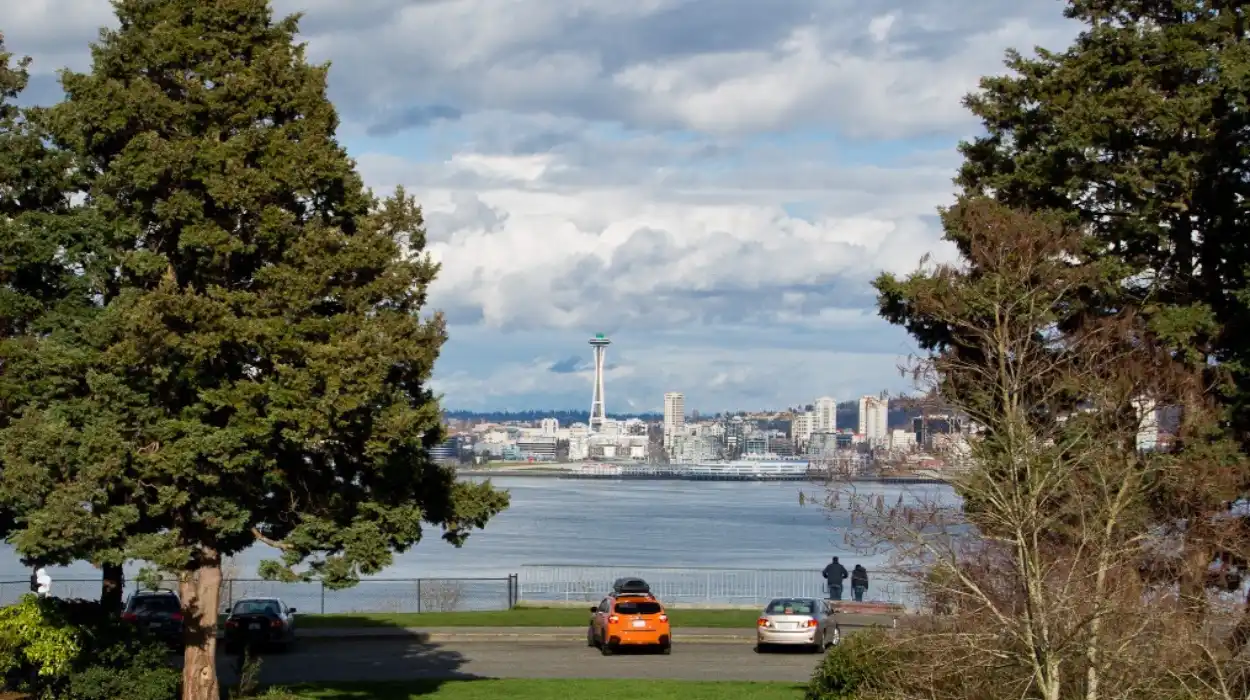
West Seattle contains several elevated vantage points that highlight the surrounding marine and mountain geography. These viewpoints allow travelers to experience the regional landscape from various heights and angles.

- Hamilton Viewpoint Park: Positioned on the northern bluff above Elliott Bay, this park delivers wide, elevated panoramas of Downtown Seattle, the industrial Harbor Island, and shipping traffic passing through the bay.
- Belvidere Park: Situated along SW Admiral Way, this eastern-facing viewpoint offers a clear perspective of the Seattle skyline framed by the Cascades, making it ideal for sunrise viewing.
- Lincoln Park Bluff Trails: The high trails within Lincoln Park provide views across the Colvos Passage toward the Kitsap Peninsula, framing passing ferries against western marine horizons.
- Don Armeni Boat Ramp Overlook: Located at water level along Harbor Avenue SW, this site provides an ideal low-angle perspective of downtown structures rising directly above the bay.
How Do Ferries and Bridges Connect West Seattle to the Region?
Transit infrastructure plays a key role in West Seattle’s coastal travel dynamics, integrating land and water transport across King County.
       [ Downtown Seattle / Pier 50 ]
                     |
             (King County Water Taxi)
                     |
                     v
   [ Seacrest Park / Harbor Ave SW ] <== (Alki Beach Promenade) ==> [ Alki Point ]
                     ^
                     |
       (Low Bridge / West Seattle Bridge)
                     |
                     v
             [ Interstate 5 ]
The King County Water Taxi
Operating between Pier 50 in Downtown Seattle and Seacrest Park in West Seattle, this passenger ferry offers a 10-minute transit across Elliott Bay. It serves both as a practical transit option and a scenic water tour, placing passengers directly onto the Harbor Avenue coastal trail.
The West Seattle Bridge and Low Bridge
Vehicular access relies primarily on the high-level West Seattle Bridge, connecting the peninsula across the Duwamish Waterway to Interstate 5 and Highway 99. Below it, the Spokane Street Swing Bridge (Low Bridge) handles freight, transit, and dedicated bicycle lanes, connecting to the Elliott Bay Trail network.
Fauntleroy Ferry Terminal
On the southwestern coast, the Washington State Ferries terminal at Fauntleroy connects West Seattle to Vashon Island and Southworth on the Kitsap Peninsula. This terminal positions West Seattle as a major gateway for broader Puget Sound exploration.
Where Are the Top Locations for Sunset Viewing in West Seattle?
Due to its western orientation facing Puget Sound and the Olympic Mountains, West Seattle is widely considered one of the premier sunset destinations in the Pacific Northwest.
| Location | View Orientation | Key Landscape Features | Recommended Activity |
| Alki Beach Park | Due West / Northwest | Open sound, Olympic Mountains, passing container ships | Evening walking, beach fires in designated pits |
| Cormorant Cove Park | Northwest | Rocky shoreline, marine bird habitat, Bainbridge Island views | Quiet photography, tide watching |
| Lincoln Park Beach | Southwest | Colvos Passage, Vashon Island ferry route, driftwood shore | Seated trail walking, sunset watching |
| Seacrest Pier | East / Northeast | Golden hour light reflecting off Downtown skyscrapers | Evening skyline viewing |
The optimal conditions for sunset viewing occur from late spring through early autumn, when clear skies allow maximum visibility across the Sound. During these months, the sun dips directly behind the peaks of the Olympic Range, casting long shadows across the water and illuminating the city skyline with warm light.

What Is the Ideal Travel Flow for Exploring West Seattle’s Coastline?
To maximize a visit, travelers should structure their route to follow the natural geography of the peninsula. A complete coastal circuit connects water transit, beach walks, and elevated parks without requiring backtracking.
Start: Seacrest Dock (Water Taxi Arrival)
  │
  ▼
Harbor Avenue Trail (Walk/Bike along Elliott Bay)
  │
  ▼
Alki Beach Park & Alki Point Lighthouse (Beach & Marine Exploration)
  │
  ▼
The Junction (Central Ridge Transit & Shopping)
  │
  ▼
Lincoln Park & Fauntleroy Cove (Forest Trails & Ferry Watching)
- Morning Arrival via Seacrest Park: Arrive via the King County Water Taxi from Pier 50. Rent a bicycle or start walking west along the flat Harbor Avenue trail, keeping the downtown skyline to your right.
- Midday at Alki Beach: Follow the paved trail around Duwamish Head to Alki Beach Park. Explore the sandy tidal areas, visit the Alki Point Lighthouse, and stroll the 2.5-mile sea wall promenade.
- Afternoon Elevation Shift: Head inland up SW Seattle Street or SW Alaska Street to reach The Junction. This elevated central hub offers local shops, transit links, and historic neighborhood architecture.
- Late Afternoon at Lincoln Park: Travel south along Fauntleroy Way SW to Lincoln Park. Walk the lower beach loop path beneath towering Douglas firs to watch the Washington State Ferries maneuver into Fauntleroy Cove.
- Evening Sunset Return: Finish the circuit along the western shoreline at Alki Beach or Cormorant Cove to catch the sunset behind the Olympic Mountains before returning via the Low Bridge or Water Taxi.
Enhancing Your Coastal Itinerary
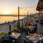
A day of exploring coastal landscapes, wind-swept beaches, and marine trails is naturally complemented by a stop at the waterfront. The peninsula’s unique geography means that shoreline activities sit right next to exceptional dining spots along the water.
Integrating a meal overlooking Elliott Bay or Puget Sound completes the regional travel experience. Pairing a morning stroll along Alki Beach with a waterfront lunch, or ending an evening sunset watch at a seaside table, allows travelers to fully enjoy West Seattle’s coastal setting.
Frequently Asked Questions About West Seattle Coastal Travel
What is the easiest way to get to West Seattle without a car?
The easiest transit method from Downtown Seattle is the King County Water Taxi, running from Pier 50 to Seacrest Park in roughly 10 minutes. Alternatively, King County Metro buses (such as the C Line) connect downtown directly to West Seattle via the West Seattle Bridge.
Is Alki Beach safe for swimming in Puget Sound?
While Alki Beach has designated sandy shoreline areas, the water in Puget Sound remains cold year-round, averaging 45°F to 55°F (7°C to 13°C). Most visitors wade, kayak, or paddleboard rather than swim long distances without wetsuits.
How much time should travelers spend visiting West Seattle?
A thorough visit requires 4 to 6 hours. This timeframe allows travelers to take the Water Taxi, walk or bike along the Alki Beach promenade, visit an elevated viewpoint like Hamilton Viewpoint Park, and watch the sunset over Puget Sound.
Are beach bonfires allowed at Alki Beach Park?
Yes, fires are permitted strictly within designated, pre-installed beach fire rings provided by Seattle Parks and Recreation. Fires are available on a first-come, first-served basis during late spring and summer seasons and must be completely extinguished by park closing time.
Can you see Mount Rainier from West Seattle shorelines?
Yes, Mount Rainier is clearly visible on clear days from specific spots along West Seattle, particularly from the eastern side of the peninsula, including Hamilton Viewpoint Park, Harbor Avenue SW, and high points near Belvidere Park facing southeast.